
Updated February 14, 2022
Looking for new dog walk adventures? Here are my family favourites! Most of these you won’t find elsewhere.
There’s a map afterwards or click on a walk for its description.
- Dry Creek, Mawson Lakes: 80-minute flat & easy linear walk or loop
- Highbury Aqueduct: 75-minute mostly flat & easy loop
- Carisbrooke Park: 80-minute flat & easy loop
- Coach Road, Skye: 65-minute uphill, hard & rough linear walk
- Pioneer Women’s Trail: 90-minute uphill, moderate loop
- Brown Hill: 45-minute uphill, hard & rough linear walk
- Moana to Port Willunga: 95-minute undulating mostly easy linear walk
- Belair Golf Club: 45 minute circular, undulating & easy loop
Number 8½ is so complex, it’s got a page all to itself! It’s a complete 16km circuit of the Adelaide parklands. .
General notes:
- All these walks are shared with other users
- Personal safety needs consideration on more isolated walks
- Snakebite is a hazard for dogs if off leash in warmer weather
See also: our guide to the off-leash dog parks of Adelaide and
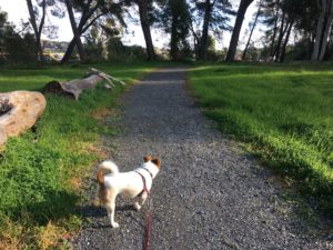
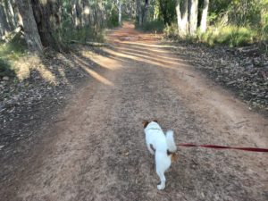
Dry Creek, Mawson Lakes
Very entertaining landscape, shops at one end, a dog park at the other
Getting There: park at either the Mawson Lakes Interchange or the McDonalds on the corner of Montague and Main North Roads.
Trail Conditions: flat, good condition (the loop option is rougher)
Directions: From the McDonalds, walk to Montague Road and immediately turn off onto the gravel path between Dry Creek and the bus depot. Follow a well-made path along the creek until you reach the off leash Mawson Lakes Dog Park. From here, you can continue over the road on sealed paths all the way to Mawson Lakes.
You can return on the other side. The path is easy all the way back to the dog park, where pram and strollers will need to cross back onto the original path. If you want to do a full loop, from here on it’s a bush-bash but very possible for the adventurous.
Duration: 80 minutes for the loop
Extension: you can explore other sections of Dry Creek. The part between Bridge and Walkleys Roads behind Yatala is especially nice.
Highbury Aqueduct Reserve
Majestic and uncrowded pine forest along a historic watercourse.
Getting There: parking is available at the ends of Historic Drive or Observation Drive
Trail Conditions: excellent, though a little thin in places and quite up and down at each end
Directions: the aqueduct trail starts at the end of Gallery Road, crosses Boundy Road and Historic Drive, follows the path past the community garden, then crosses Mulberry Drive before descending to the Torrens Linear Path.
A loop can then be made by following the Torrens back to your starting point. There are several points where the loop can be shortened using road or trails.
Duration: 1 hour 35 minutes
Extension: you can walk along the Torrens further in either direction. At the branch after Mulberry Drive (pictured) I hear of people visiting a quarry and a swimming hole but the legalities of this are uncertain!
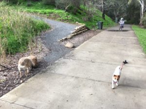
Jenkins Reserve to Carisbrooke Park, Salisbury
Wide space with many paths, plus red cliffs & dog parks
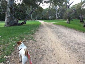
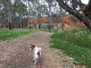
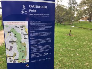
Getting There: good car parking is available at either Jenkins Reserve via Saints Road, Salisbury or Carisbrooke Park off Main North Road just north of the river.
Trail Conditions: flat, good condition, mostly sealed (the loop requires some unsealed track)
Directions: a circular walk on each side of the Little Para River. Access to the whole North side requires walking up a slope and following the river along the top of sandy cliffs before descending again. It is possible to cross the river at several places and avoid rough paths to allow pram access. There’s even a set of off leash dog parks at Jenkins Reserve, plus playgrounds, toilets and picnic areas at several places.
Duration: takes us 1 hour, 20 minutes
Extensions: the Little Para River Trail is 14km in total. It continues for a short distance across Main North Road, and for a long distance from Jenkins Reserve via Porter and Brian Streets.
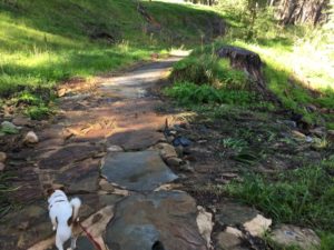
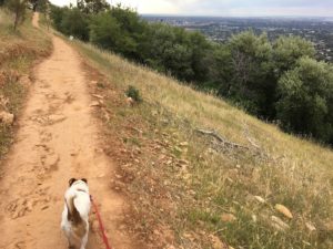
Coach Road, Skye
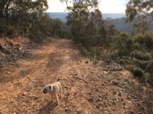
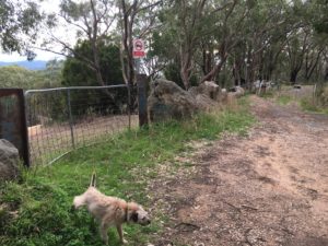
A steep, secluded and rewarding climb through bushland
Getting There: drive up The Parade, turn right onto Coach Road to the car parking area at the end.
Trail Conditions: wide but very rough and steep in places, unsuitable for wheelchairs or prams
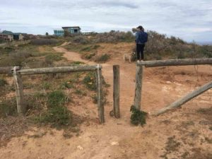
Directions: This is a linear ‘out-and-back’ walk. Go around the white gate at the car park and you’re in open bushland. It goes down, then quite steeply up a thigh-burning rocky fire trail. It then levels out until the trail forks; go right to avoid the conservation park for the steep final 200m to the top (the gate you go around is pictured behind Tinker). The last part is quite rough but of course, you can turn anytime you like.
Duration: Takes us 1hr 5min.
Extensions: you can keep going to Ashton or Summertown but it’s a long walk without a driver.
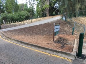
Pioneer Women’s Trail, Beaumont
Extensive trail network leading to stunning views. That’s one at the start.
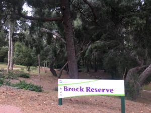
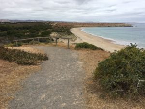
Getting There: start at Brock Reserve at the end of Glynburn Road. You can also enter from the end of Dashwood Road or a track most of the way along Waterfall Gully Road (pictured).
Trail Conditions: mix of fire trails and single person width track, rocky in places, unsuitable for wheelchairs or prams
Directions: You can go up on a variety of trails and descend in a loop. Fantastic views reward you at the top. The Centre Track section is very steep but can be avoided by retracing your steps instead.
Duration: takes us 90 minutes
Extensions: carry on along the Bullock Track behind Glen Osmond Golf Course or cross Glen Osmond Road at the top onto a fire trail that skirts the hills face to Sunnyside Rd.
Brown Hill, Carrick Hill
A secret gem right on the city edge
Getting There: the McElligott’s Quarry carpark is at the end of Carrick Hill Drive
Trail Conditions: steep and rough, unsuitable for wheelchairs or prams
Directions: from the carpark, walk back to the entrance and go right up the wide concrete driveway that looks private. When it turns right, go straight ahead through the gate, THEN turn right up the gravel path. Avoid the gate to Waite Conservation Park (dogs not permitted) and keep going up. At the top, turn left to go to the highest point. Excellent views await you.
Duration: takes us 45min
Extensions: the walk along Brownhill Creek is a lot of fun for kids with rock-hopping and fairy houses. It can be accessed by going down the the Yurebilla Trail from the carpark instead of up. It takes us 90 mins to do the loop to the manure pits and back
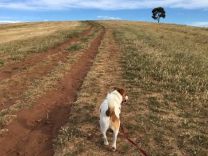
Moana to Port Willunga Coastal Walk
Like the Yorke Peninsula, only right here!
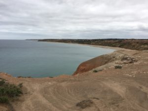
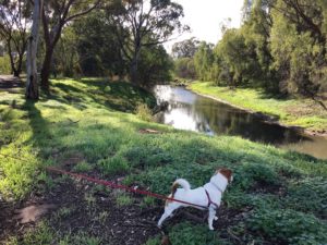
Getting There: start either where the Esplanade meets Lennard Drive in Moana (the first picture shows the start) or at the car park on the Esplanade in Port Willunga. This walk is best done with a car at each end.
Trail Conditions: A rough but distinct narrow path which follows the cliff tops. Some inlets and gorges have rough surfaces and erosion unsuitable for wheeled transport or infirm people.
Directions: Follow the coast between the two settlements, generally keeping between the private land and the cliff edge. Therefore, leashes are essential. The path drops down into Port Willunga and Maslins Beach but is easy to pick up again on the other side.
Duration: takes us 120-150 min
Extensions: Drive to the Victory Hotel for lunch, then walk it off up Old Sellicks Hill Road just behind the hotel to the right (closed to cars).
Many beaches along this walk are leash-free- click here to learn more.
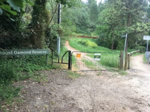
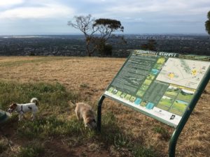
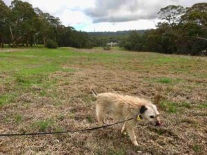
Belair Golf Club
A real adventure through an abandoned golf club, also called Belair Country Club.
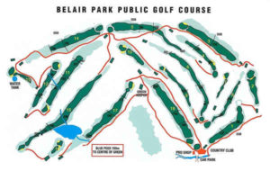
Getting There: parking is available at the Caravan park entrance on Upper Sturt Road. Currently parking is free (if you reach a pay booth, you’ve entered Belair National Park to the north). There are also entrances from the road to the south.
Trail Conditions: good, gravely, but some areas require walking on overgrown golf course fairway. This will be hard going with prams and wheelchairs.
Directions: start on the trail behind the gazebo to the left as you pass the country club house. Use the map to connect up the trail segments.
There’s a serviced toilet in the middle of the park, which you’ll see from the northern trail.
Duration: one hour
Extensions: you can also take dogs on leash into Belair National Park but this place has much more freedom and fewer people.
In conclusion, a disclaimer. These adventurous walks aren’t guaranteed to be safe. Owners use these walks at their own risk.
Adelaide has lots of other good places to walk dogs close to the city. You can find two more excellent lists here and here. O’Halloran Hill deserves a special mention. Or why don’t you share your favourite in the comments section? Happy walking!
Related: How Far Can Dogs Walk? | How To Start Walking Puppies
Have something to add? Comments (if open) will appear within 24 hours.
By Andrew Spanner BVSc(Hons) MVetStud, a vet in Adelaide, Australia. Meet his team here.
Hi thank you for this it is so informative! Are they all off-leash friendly for the most part of the trails?
Thanks
Makie
Hi Makie. None of them are officially off leash. Although many people do let their dogs loose on these walks, here are some things to consider: snakes, road crossings, other users (especially bicycles), respect for wildlife bear bushland, cliff edges on PWT & the coast. As these are more adventurous than standard walks, my advice is to use a leash. Coach Road, Brown Hill and Belair golf course contain the fewest hazards.